The Emergency Weather Bulletin has been updated, according to which the severe effects will last until Saturday night (11/16). As reported by EMY, the bad weather ALEXANDROS is ongoing, with heavy rains and storms that will be accompanied by hailstorms, a high frequency of lightning, strong winds and a noticeable drop in temperature in northern Greece. The phenomena will be dangerous in places and will last until Saturday night.
Thessaly, the Sporades, central and northern Evia as well as the northeastern parts of eastern Sterea will receive the highest amounts of rain. Nevertheless, in the rest of the areas mentioned below, storms will show great rapidity.
ADVERTISING SPACE
In more detail:
A. Heavy rains and storms are predicted today Saturday 11-16-2024:
a. Until the morning hours (08:00) in southern parts of western and central Macedonia.
b. Until the late afternoon (18:00) in Thessaly, the Sporades and eastern Sterea and until the evening hours (21:00) in Evia.
The phenomena are expected to be particularly intense in eastern Thessaly (N. Larisis, N. Magnesia), the Sporades, central and northern Evia and temporarily in the northeastern parts of eastern Sterea (N. Fthiotida, N. Viotias).
c. Until the evening hours (20:00) on the islands of the eastern Aegean and the Dodecanese.
d. Until the early hours of the morning (05:00) in the Cyclades and again in the evening (20:00 – 24:00).
e. From the afternoon hours until the night (15:00 – 24:00) in the western parts of Crete.
Also, strengthened northeast winds of intensity 8 to 9 Beaufort are expected to prevail in the northern Aegean until Saturday evening. Strong north northeast winds of intensity 8 Beaufort will also blow in the central Aegean.
ADVERTISING SPACE
See the detailed weather forecast until Wednesday 20/11
In the eastern mainland (except eastern Macedonia and Thrace) and the Aegean islands, increased cloudiness with local rains and sporadic storms is forecast. The effects will be locally strong in western and central Macedonia, Thessaly, the Sporades, eastern Sterea, Evia, the islands of the eastern Aegean, the Dodecanese, the Cyclades and the western parts of Crete.
In the rest of the country, few clouds are forecast, temporarily increased with local rains and sporadic storms in the Ionian and in the western continental areas. The phenomena will quickly weaken in the northern continental areas, gradually in the Ionian and the remaining continental areas and at night they will be limited to the Aegean.
Snowfall will occur in the highlands of the central and northern mainland.
ADVERTISING SPACE
Winds will blow from north directions 4 to 6 Beaufort, in the Aegean up to 7 to 8 and in the northern Aegean locally 9 Beaufort.
The temperature, falling from north to south, is expected to fluctuate 4 to 6 degrees below the normal levels for the season. It will range in the northern continental areas from 01 to 13 degrees, in the Ionian and the rest of the continental areas from 09 to 19 degrees and in the Cyclades and the islands of the eastern Aegean from 14 to 20 and locally in Crete and the Dodecanese up to 22 degrees Celsius.
MACEDONIA, THRACE
Weather: Clouds with rain in the morning hours in western and central Macedonia, strong in places in the southern parts, where isolated storms may occur in the maritime – coastal areas of central Macedonia. Gradual improvement from midday hours.
Snowfall will occur in the morning hours in the mountains of western Macedonia.
Winds: North northwest 4 to 6 and in the east northeast 6 to 7 and locally 8 Beaufort, weakening in the evening hours.
Temperature: From 04 to 13 degrees Celsius. In western Macedonia 2 to 3 degrees lower.
IONIAN ISLANDS, EPIROS, WEST STEREA, WEST PELOPONNISOS
Weather: Temporarily increased cloudiness with local rains and mainly in the marine – coastal isolated storms that in the midday hours will be limited to the southern Ionian and the western Peloponnese and by the afternoon they will stop and the weather will improve.
Snowfall will occur in the morning hours in the mountains of Epirus and western Sterea.
Winds: North northeast 4 to 5 Beaufort, weakening in the evening hours.
Temperature: From 09 to 19 degrees Celsius. In the interior of Epirus 4 to 5 degrees lower.
EASTERN STEREA, EVIA, EASTERN PELOPONNISOS
Weather: Temporarily increased clouds with local rains and sporadic storms, locally strong in central and northern Evia and temporary in the northeastern parts of eastern Sterea (Fthiotida prefecture, Voiotia prefecture). From the afternoon the phenomena in the eastern Peloponnese will stop, in the eastern Sterea they will weaken and in Evia they will continue with weakening in the evening hours.
Snowfall will occur in the morning hours in the mountains of Thessaly.
Winds: From north directions 4 to 6 and in the east to 7 to 8 Beaufort.
Temperature: From 08 to 17 to 18 degrees Celsius.
CYCLADES, CRETE
Weather: Temporarily increased clouds with local rains and sporadic storms at intervals. The phenomena will be locally intense up to the Cyclades in the morning hours and again in the evening and in western Crete from the afternoon until the night.
Winds: West northwest 4 to 6 and gradually to the west north 7 to 8 Beaufort.
Temperature: From 14 to 20 and in Crete locally up to 22 degrees Celsius.
EAST AEGEAN ISLANDS – DODECANISE
Weather: Clouds temporarily increased with local rain and sporadic storms, locally strong until the evening hours.
Winds: In the north northeast 7 to 8 and locally 9 Beaufort, weakening in the evening hours. In the south from southern directions 3 to 5 Beaufort and from the afternoon from western directions with the same intensity.
Temperature: From 14 to 22 degrees Celsius. In the north 4 to 5 degrees lower.
THESSALY
Weather: Increased clouds with rain and sporadic storms locally strong. The phenomena will be particularly intense in eastern Thessaly (Larsis, Magnesia) and the Sporades until late afternoon. In the evening hours, the phenomena will be limited to eastern Thessaly and the Sporades and will weaken.
Winds: From north directions 4 to 6 and in the east northeast to 7 to 8 and in the Sporades to 9 Beaufort, gradually weakening from the afternoon.
Temperature: From 06 to 14 degrees Celsius.
ATTICA
Weather: Clouds temporarily increased with local rain and sporadic storms, mainly in the northern parts where it is likely to be temporarily hot until noon. From the afternoon the phenomena will weaken and in most areas will stop.
Winds: From the north directions 4 to 6 and to the east 7 local 8 Beaufort, with gradual weakening from the evening hours.
Temperature: From 12 to 18 degrees Celsius.
THESSALONIKI
Weather: Cloudy with local rains in the morning hours, where isolated storms are likely to occur in the sea-coastal areas and gradual improvement from midday hours.
Winds: North northwest 4 to 5 and in the morning hours locally 6 Beaufort, with gradual weakening from midday hours.
Temperature: From 05 to 12 to 13 degrees Celsius.
FORECAST FOR TOMORROW SUNDAY 17-11-2024
In eastern Thessaly, Evia, eastern Sterea, the Aegean islands and Crete, clouds are forecast temporarily increased with local rains and until midday sporadic storms in Crete as well as in the southernmost parts of the Cyclades and the Dodecanese. The phenomena will gradually weaken and be limited to Crete and the Dodecanese from the north.
In the rest of the country the weather will be generally sunny.
Visibility will be locally limited in the evening hours in continental, mainly mountainous areas.
The winds will blow from northern directions, in the west 3 to 5 Beaufort, in the east 4 to 5 and in the Aegean 6, temporarily in the morning hours locally 7 Beaufort.
The temperature will not change appreciably. It will range in the central and northern continents from 04 to 14 to 15 and locally 16 degrees. In the Ionian and the rest of the mainland from 10 to 17 to 18 and locally 19 degrees and in the Cyclades, the Dodecanese and Crete from 14 to 19 to 20 and locally in Crete 21 degrees Celsius.
FORECAST FOR MONDAY 18-11-2024
The weather is expected to be generally clear throughout the country with a few clouds temporarily increasing in the western and central mainland, in the Ionian, in the northern and eastern Aegean and in Crete as well as with local rains in the southern Dodecanese in the early hours of the morning.
Visibility is likely to be locally limited in the morning and evening hours in continental, mainly mountainous areas.
The winds will blow north-northwest 3 to 4 and on the southern seas locally 5 to 6 Beaufort with weakening from the afternoon. From late afternoon in the west variable 3 to 4 Beaufort.
The temperature will rise slightly.
FORECAST FOR THN TUESDAY 11-19-2024
In the Ionian, the western mainlands and the Peloponnese, increased clouds with rain are forecast in the morning hours in the eastern Peloponnese and from noon in the Ionian and the western mainlands. Sporadic storms are likely to occur in the northern Ionian during the evening hours.
In the rest of the country generally clear weather.
Visibility is likely to be locally limited in the morning hours, mainly in the west.
Winds will blow in the west from south directions 3 to 4 and locally in the Ionian 5 Beaufort and in the east from north directions 3 to 4 Beaufort gradually turning to southerlies with the same intensity.
The temperature will rise slightly further, mainly in the west and south.
FORECAST FOR THN WEDNESDAY 11-20-2024
In the Ionian, the western mainlands, Crete and gradually in central and eastern Macedonia, Thrace and the eastern island country, increased clouds with rain are predicted in the Ionian, the western mainlands and from noon in Thrace and the eastern island country. Sporadic storms will also occur in the northern and central Ionian, Epirus and western Sterea.
In the rest of the country generally clear weather.
Winds will blow south southwest 4 to 6 and locally on the seas up to 7 Beaufort.
The temperature will rise across the country.
Watch Live the development of the bad weather “Alexandros”:
What problems have been created in the country so far?
Despite the fact that the intensity of the bad weather was not great, there were quite a few problems especially on Friday afternoon (11/15) in many areas of the country. Videos and images posted online show flooded streets and heavy rainfall in Athens, Piraeus and Crete. Strong storms also hit Ilia.
A strong storm is approaching the prefecture of Ilia
See live image https://t.co/WH35AUZSpRcameras/cameras-west-greece/zaharo-ileias-south.html pic.twitter.com/7WbeHr1I5u
— Forecast Weather Greece (@ForecastGreece) November 13, 2024
In Patras, students were trapped in their flooded school. In Western Macedonia, heavy snowfalls have begun in the mountains and are expected to descend towards the lowlands by the end of the year. Problems with flooding phenomena also occurred in Syros.
The authorities in Chios are on alert
The forces of the Fire Service in Chios have already taken positions based on the approved action plan and will remain until the phenomena subside, as reported to alithia.gr by the commander of the Fire Service of Chios, Dimitris Liotsios. It draws attention to citizens to avoid traveling during heavy rains.
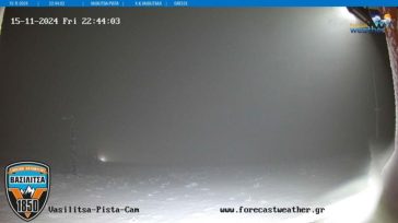
Snowfall in Pisoderi, Vasilitsa and Seli
The snowfall is heavy in the ski resorts of Pisoderio, Vasilitsa and Selio:


The roads in Patras were flooded by the heavy rainfall
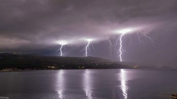
Intense lightning activity at Roditses beach in Samos

Source: www.zougla.gr


